


Select NOAA-NWS Forecast Office Text Products
(Product availability varies with seasons, forecast office, and weather.)
Forecast Discussion for Dallas/Fort Worth, TX
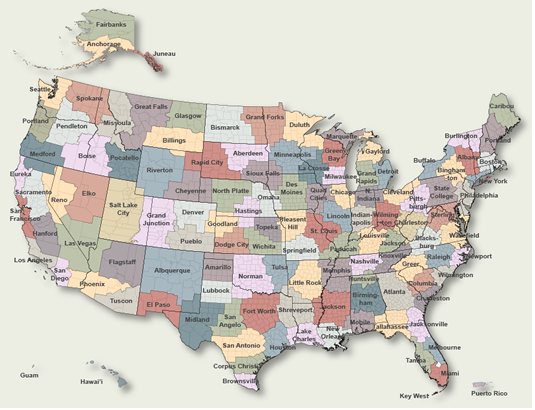
To Select Another NWS Office Click on Map or Choose from List
|
| Select Forecast Office: | Select Product: |
178 FXUS64 KFWD 171041 AFDFWD Area Forecast Discussion National Weather Service Fort Worth TX 541 AM CDT Fri Apr 17 2026 ...New AVIATION... .KEY MESSAGES... - A cold front will move through on Saturday, accompanied by scattered showers and storms. Any stronger storm could produce small hail and strong winds. - Much cooler conditions are expected this weekend into early next week before temperatures warm back up. - Low rain chances are expected to return to the region over the first half of next week. && .SHORT TERM... (Today and tonight) Issued at 150 AM CDT Fri Apr 17 2026 A relatively quiet start to the day is expected for the last day of the workweek, with a rinse-wash-repeat deck of low stratus spreading across the region near daybreak. Similar to yesterday, we remain east of the ever-present dryline draped across Texas. Continued southerly winds will aid in bringing afternoon temperatures into the 80s to around 90. Across the western CONUS, a longwave trough and closed upper low will continue east into the Plains, with additional smaller-scale disturbances rounding the base of the trough. The forward movement of this system will shunt a strong cold front southward. Out ahead of this front, a deepening lee-side surface low will move into the Panhandles, increasing wind speeds over the course of this afternoon and evening. The majority of today will remain dry as guidance continues to confine better lift northward as well as keep an elevated capping inversion in place through the afternoon. While we cannot rule out very isolated development along the dryline to our west (likely about a 10% chance), any afternoon convection will likely remain well to our north in northern Oklahoma and Kansas closer to the triple point. The front will advance into our northwestern counties around 1 to 2 AM on Saturday, pushing swiftly south through the morning accompanied by cooling temperatures and breezy north winds. Enough moisture ahead of the boundary will allow for messy showers and storms to develop near and behind the front. The overall severe weather risk in our area is on the lower end due to us being so far removed from the better source of lift, however efficient instability and deep-layer shear along with 7-8 degC/km lapse rates will keep the potential for a couple strong to marginally severe storms capable of hail and strong winds. Strength and coverage of storms along the front is expected to decrease as they move into Central and South Texas later in the morning, though scattered showers/storms will continue to linger for much of the day while the base of the parent trough passes through the Plains. Eventually, precipitation will come to an end overnight into Sunday morning, leaving behind cooler temperatures to end the weekend. && .LONG TERM... (Saturday through Thursday) Issued at 150 AM CDT Fri Apr 17 2026 As the surface high slides into the region Sunday morning, we will experience our coolest temperatures in the forecast with morning lows dropping into the upper 30s to around 50. Ridging will build into the region Sunday into early next week, leading to a gradual warm up back into the 70s and even 80s towards the end of the forecast period. Expect a quick return of Gulf moisture starting Monday as the region finds itself on the western periphery of the low-level ridge, just in time for a few disturbances to move over the Southern Plains and bring returning rain chances the first half of the week. Continued unsettled weather is likely towards the end of the week as troughing moves into the Desert Southwest and advances east. More details will become available as we get closer in time, so make sure to check back. && .AVIATION... (12Z TAFS) Issued at 539 AM CDT Fri Apr 17 2026 MVFR cigs are expected to continue to gradually shift north and fill in over the next several hours. Any MVFR cigs will lift and scatter out by the afternoon, leaving behind VFR and wind gusts up to 25-30 kt for much of today. While sustained speeds remain around 15 kts overnight, gusts will lighten a bit temporarily before a strong cold front moves through and brings gusty northerly winds. Scattered showers and storms are expected near and behind the front going into Saturday morning, along with a period of MVFR cigs. The front is currently expected to reach D10 between 08-09Z, and closer to 12Z for ACT. Showers are expected to linger through the rest of the period and the -SHRA may need to be extended past 14Z in D10. Timing for precipitation will likely become more refined in the coming issuances. && .SPOTTER INFORMATION STATEMENT... Issued at 129 AM CDT Thu Apr 16 2026 Spotter activation is not expected at this time. && .PRELIMINARY POINT TEMPS/POPS... Dallas-Ft. Worth 84 55 64 46 / 10 70 50 10 Waco 85 59 65 46 / 0 30 60 30 Paris 82 54 61 42 / 10 70 50 10 Denton 82 52 64 41 / 10 70 40 10 McKinney 82 55 63 43 / 10 70 50 10 Dallas 84 56 64 47 / 10 70 50 10 Terrell 84 58 62 43 / 10 60 60 20 Corsicana 87 62 66 47 / 0 40 60 40 Temple 87 62 65 48 / 0 20 60 40 Mineral Wells 84 52 64 41 / 10 60 40 10 && .FWD WATCHES/WARNINGS/ADVISORIES... None. && $$ SHORT TERM...Prater LONG TERM....Prater AVIATION...Prater |
Previous Forecast Discussions may be found at
NWS Dallas/Fort Worth, TX (FWD) Office Forecast Discussions.
(Click 'Previous Version' there to view past versions successively.
Some may differ only in time posted.)
Products Courtesy of NOAA-NWS
NWS Information Parsing Script by Ken True at Saratoga Weather - WFO and Products Scripts by SE Lincoln Weather.
Mapping by Curly at Michiana Weather and by Tom at My Mishawaka Weather.